Thursday, March 30, 2017

East Rift Valley and East Coast of Taiwan

My husband has posted a lot of pictures of this area with some good description of what we saw.  So to to http://de-intimidator.blogspot.co.id/ for that information.  This was a long car ride with much less walking and practically no stairs!  We drove to the top of a mountain to a hotel that was named Far Glory - also owned by a conglomerate who also own a lot of other things in this area - most of those things named Far Glory this or that.  But we went up to see the view of the Rift Valley - so here it is:


Next we drove a little further to get a view of the Pacific Ocean.  The day is overcast - so pictures not so good.


And a shot the other direction just to show how they are trying to use all the useable land for farming. If you blow it up you can see some cultivation in the lower left side of the picture.

As we were driving our tour guide, Alisha spotted a field of sun flowers.  How could we not stop at this photo op!


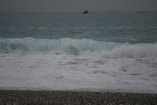
We stopped at several viewpoints along the coast.


Another location - I could imagine all the grandkids having a blast here - while their parents cringed.


No sheer drop offs - just lots of sharp edges and places to fall.


More shots of the water - One spot the water was coming from two different directions that caused some interesting swirls!


Our guide took the obligatory picture of us in front of the attraction.
As we drove on I saw some rice fields and asked Alisha to stop.

There were some stands alongside the road selling bamboo shoots.  They peel them and you buy them to cook with.


In this last photo he is holding a vegetable that is unique to Taiwan - fiddle head ferns.

Alisha next took us to see some forests.  She pointed out some trees and said they were Beatlenut trees.

Later she showed us how to identify where you can buy the end product.  It is almost like tobacco snuff that you chew, but has a little high to it.  The problems it can cause the user are about the same as tobacco use.  Plus you have the problem of them spitting it out in the streets.  There were signs in some of the metro cars warning tht beatlenut chewing was not allowed!
She then showed us an area where the Japanese had started growing and processing cypress trees when they had control of the country.  Called Morisaka, it is mostly a tourist spot now.  They use some of the buildings to house the wooden sculptures that have won prizes over the years.  Here are a couple of samples.


And last - a typical street scene we saw on the drive.  It seems all of Asia is plaged with many wires poluting the view.


Tuesday, March 28, 2017

Taroko National Park

We took the train from Taipei to Hualien, Taiwan to see a different part of Taiwan.  We had booked a two day tour with a company called MeetMyGuide.  Our first day was to the Taroko National Park.  Our guide/driver picked us up at our hotel and drove north to the park.  On the way we stopped at Cingshuei Cliff where he explained that on a good day you could see 5 shades of blue in the ocean.  Each shade of blue away from the shore showed that there was a drop in elevation.  No one is allowed to swim in this part of the ocean because of the dangerous tides caused by the steep drop offs.  The weather is continuing to be cloudy and hazy so we could only see 3 shades of blue.

All along this trip Vincent our guide pointed out earthquake damage.  They mostly just close the old bridge/tunnel or whatever and build a new one near it.  Note the rock slide to the left of the tunnel in the first picture.  In the next, the old entrance to the tunnel is left there and a new one build in front of it.

The original gate entrance to the Taroko National Park is still intact.  They have build new roads around it so that they can have two way traffic.

We went to the visitors center twice - first Vincent wanted us to see the pictures that showed the different parts of the park - we later went back for lunch.  In front of the center is a statue of a
Taroko women.  They had facial tattoos on their checks and on their foreheads.  The male statue was in a different location and because we were traveling I did not get a picture.  The males are tattooed on their chin and forehead.  The one on the forehead is to show that you are ready to be married or already married.

Our next stop was at the Eternal Springs Shrine.  There were two higher structures that were part of this complex - but the paths are closed due to damage from earthquakes.  I should explain that they have an average of about 20 earthquakes a day - that is not a mistake!  Most of them are quite small and you don't really feel them.  I had several experiences of dizzy spells - something is not quite right - but it passes so quickly that I just dismissed them.  They were most likely earthquakes.  The only other time I have experienced an earthquake was about 11 years ago in Japan.  That one was around a 5.4 - the car shook!  The Eternal Springs Shrine is in commemoration of all the people who died building all the bridges and tunnels to make the roads through the mountains a reality.  Here is a photo of the lower portion of the shrine.
You see a lot of red bridges in a lot of Asia.  The lower portion looks like a lookout - but nothing to see.  Perhaps it was once a bridge?  There was a path to the right that led to the shrine in the upper picture - closed because of damage to the path.

Vincent drove us to another viewpoint that just happened to be by a temple.


The suspension bridge was located just before the entrance to the temple.  Surprisingly this path was open - maybe because it led into the mountains away from the road.  It was very steep and was a much longer hike than we wanted.
Then we went into the marble gorge itself.  I won't bore you with a ton of pictures.  It is pretty impressive though.  We ended up hiking about 1 1/2 hours, some in bits in pieces along the gorge.  The last section was long, about 40 minutes, and led through a pitch black tunnel.  Vincent said to use our cell phones - but that was not near enough light.  We had seen cell phone towers in various areas - so I decided to try to download a flashlight app to my phone.  It took a while to download - but it worked.  It was enough light to get us through the 3 minute tunnel!  Don't I look cute in this stylish hat?


After we left the gorge we drove down to the shore and stopped at a beach.  It was around 4-4:30pm and very cloudy and hazy.